
Browse the Fullerton Street Directory
The address is the anchor. A street number can point to a parcel, a tax mailing destination, a recorded legal description, a permit file, or a historic directory entry, but those records do not all describe the same human fact. A Fullerton street directory therefore needs a clear order: locate the property, identify the parcel, test ownership, then look for older or restricted person evidence.
Follow the chain in five moves. Record the source and date at each move. If the address is a corner lot, multifamily parcel, private street, or place near a city boundary, keep the map context with the search notes. Permits and code files are a later corroboration lane, not a substitute for the parcel-to-deed sequence.
- Begin with the exact street address, preserving directional prefixes, suffixes, old spellings, and any known date or number change.
- Enter that address in Fullerton GIS and select the standardized address point. Note the APN, parcel shape, ZIP, zoning, city-limit setting, and nearby parcels.
- Use the Orange County Assessor’s property-information channel or Public Service Counter to compare the situs address, assessment display, mailing address, legal description, and property characteristics.
- Search the Orange County RecorderWorks index for the likely owner or seller. Capture the document date and identifier, then obtain the deed or other recorded copy so the legal description can be checked.
- Use voter information only through the voter’s own status tool or an approved statutory file purpose. For past occupants, ask for the street or householder section of a library criss-cross directory.
Fullerton Street Records by Address
The same address can appear in several Fullerton record systems with different keys and different limits. The coverage table separates map geometry from assessment, recorder parties, permit and code activity, historic directory entries, and voter data. That distinction prevents a parcel polygon from being read as a person list or a deed party from being called an occupant.
| Record type | Key | What it shows | What it does not establish |
|---|---|---|---|
| GIS geometry | Address, map, APN | Parcel shape, city limit, ZIP, zoning, nearby geometry | Owner or resident identity |
| Assessment | APN or situs address | Ownership or assessment display, mailing address, values, characteristics | Every person who occupies the parcel |
| Recorder parties | Grantor, grantee, document, legal parcel | Recorded ownership or security-document trail and dates | Occupancy or a complete household |
| Permit and code | Address, APN, case | Owner, applicant, contractor, work, inspections, notices | Residence or private complainant identity |
| Historic directory | Street name and number, year | Listed occupant, telephone, occupation, or householder clues | Complete coverage or legal title |
| Voter data | Authorized file or own-record identity | Registration status, precinct, approved fields | A casual public street roster |
The APN is the best link among current map, assessment, deed, and permit records. A directory adds a separate occupant layer, while a voter result is restricted by California law. Read each row as an answer to one question, then state which questions remain open.
Fullerton GIS Street and Parcel Layers
Fullerton GIS and GoZone provide the street-browse stage of the address search. The city’s public MapServer inventory includes City Address and Address Point, Parcels, Zoning Boundary, Zoning, City Limit, ZIP Code, Private Streets, Community Development Type, and other specialized layers. Turn on only the layers needed for the address, because a crowded map can hide the parcel edge or make a postal boundary look like a municipal one.
Use the address locator first, then zoom until individual parcel polygons are visible. Click the anchor parcel and save the APN or other attribute shown by the active layer. Click adjacent parcels separately rather than assuming that touching geometry equals one ownership record. Basemap and legend controls provide context, while measure or select functions are app-dependent and should not be treated as guaranteed services.
| GIS field or control | Type | Use in a Fullerton street search |
|---|---|---|
| Address locator | Autocomplete text | Select a standardized street address |
| Map zoom and pan | Map controls | Browse a street segment and adjacent parcels |
| Layer list | Checkboxes | Toggle addresses, parcels, zoning, city limit, ZIP, and specialized layers |
| Identify or click parcel | Map action | Open the active layer’s attribute pop-up when available |
| Basemap and legend | Map controls | Supply road, boundary, and symbol context |
| Measure or select | App-dependent | Define a visible area only when the chosen Fullerton app supports it |
Note: Fullerton’s MapServer reports a 1,000-record maximum, so smaller street or parcel queries are easier to inspect and verify.
Fullerton Situs and Legal Parcel Clues
Three address identities often travel together but do different work. The situs is where the parcel physically sits. The mailing address is where an owner or tax notice is sent. The legal parcel is the lot, block, tract, or metes-and-bounds description used in recorded documents. A Fullerton street directory becomes more reliable when all three are recorded instead of treating a postal line as a legal boundary.
- Parcel
- A mapped unit of land identified by an APN or related assessor reference. It is a geographic and assessment anchor, not a list of occupants.
- Situs address
- The physical location used by GIS, permits, and assessment records. It can change when a road or number is changed.
- Plat or legal parcel
- The recorded lot, block, tract, or boundary description that lets a deed be compared with the map.
- Criss-cross directory
- A historic address or householder section arranged by street and number, often showing a listed occupant rather than the legal owner.
A matching situs and tax mailing address supports an owner-occupancy hypothesis but does not prove it. A different mailing line may point to a trust, management office, former address, or another parcel. Compare the assessment record with the deed, a directory year, and any public permit evidence before drawing a conclusion.
Fullerton Assessor and ParcelQuest Limits
The Orange County Assessor’s Property Information and Parcel Maps page is the official gateway for Fullerton property context, but the web path sends users to an external ParcelQuest service. The county states that property data must be verified and identifies the Public Service Counter at 500 S. Main Street, 2nd Floor, Orange. The public owner-name web search was not verified during research, so a street directory should never promise unrestricted online owner browsing, bulk owner export, or a ZIP-filtered owner list.
A parcel record may show APN, situs, assessment or ownership display, mailing address, legal description, land and improvement values, tax year, use, property characteristics, and transfer or reassessment indicators depending on the service tier. Assessor counter access is the fallback when an external result is incomplete. The Treasurer-Tax Collector’s secured-property tools are mainly keyed by APN and tax identifiers, and tax status proves a parcel obligation rather than residence.
Use the assessment result to frame the deed search. It is evidence of an ownership association and a way to find the right legal parcel. It is not a household list, and a mailing match is not a finding that every adult at the address is the listed owner.
Fullerton RecorderWorks Along a Street
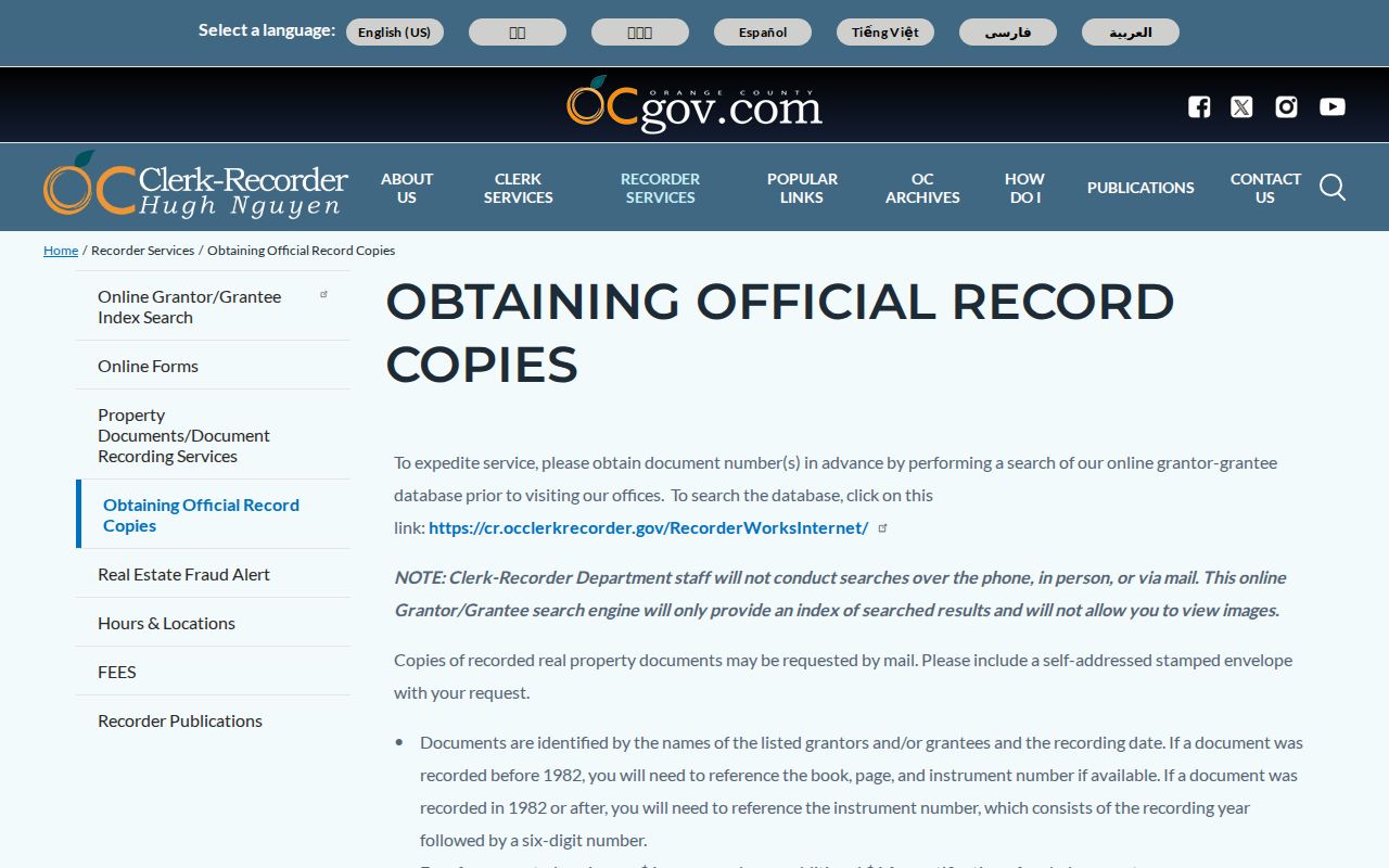
RecorderWorks is the Orange County grantor-grantee index for the deed portion of a Fullerton street directory. Search a likely party in both roles, narrow by recording date, and record the document type and identifier. A result may involve a deed, deed of trust, reconveyance, lien, notice, map, or another title-related document. It does not display images, so the index result is only the bridge to an official copy.
Post-1981 records use the recording year plus a six-digit instrument number. Pre-1982 requests depend on book, page, and instrument references. The change is a search-mechanics break, not a claim that all earlier history is absent. Orange County says staff do not run the search for the requester. Copies cost $1 per page plus $1 certification per document or map, and the recorder’s mailing address is 601 N. Ross Street, Santa Ana, with questions at (714) 834-2500.
The Orange County official-copy instructions show the difference between a free index result and a paid document request.
| Indexed parties | Grantor and grantee names and roles |
|---|---|
| Document identity | Recording date, document title or type, and post-1981 instrument number |
| Earlier reference | Book, page, and instrument fields for pre-1982 copy work |
| Image access | Not displayed in the online index; order a copy or use recorder services |
| Occupancy field | None. Read the legal description and compare separate address evidence |
The Orange County Recorder copy instructions are the source for Fullerton deed and document follow-through.
Read the deed’s grantor, grantee, recording date, vesting, and legal description against the APN. That comparison can trace owners along a street, but it still cannot establish that a grantor, grantee, or lienholder lived at the parcel.
Fullerton Permits and Code Cases by Address
Fullerton Community and Economic Development supplies online permitting, a historic permit archive, code enforcement, planning files, and a document archive. The public walk-in counter is listed Monday-Friday 7:30 a.m. to noon, with 1-5 p.m. access by reservation. Building Division is (714) 738-6541, inspections (714) 738-6542, code (714) 738-6553, and zoning (714) 738-6559. Those channels are useful when a street address needs a construction or compliance date.
A permit may name an owner, applicant, contractor, architect, project address, APN, work description, valuation, issue or final date, and inspection milestones. It proves an association with a property or project, not residence. Older permits were reported on microfiche at the second-floor Development Services counter and may identify a builder, construction cost or type, architect, room or story measurements, and the first footing inspection marker called “FOO.O.K.” Current retention and access should be confirmed with the city.
Code complaints can include protected complainant details. Ask for an address-keyed case log, notices, orders, inspection dates, and public correspondence rather than private reporting-party information. Business, alarm, parking, engineering, and wastewater permit channels can add a public organization or responsible-party clue, but security and personal contact fields may be redacted.
Fullerton Street Names, Numbers, and ZIP Context
Harbor Boulevard runs north-south through central Fullerton, while Commonwealth and Chapman provide major east-west references. Directional prefixes, suffixes, and exact street numbers matter in deed, permit, and directory searches. Fullerton Heritage warns that street names and house numbers can change. When an old number fails, compare the APN, lot or block, historic maps, Sanborn sheets, subdivision map, and neighboring landmarks instead of assuming the address never moved.
Postal Fullerton is not the same as municipal Fullerton. The city-limit layer determines city jurisdiction, while USPS assigns delivery names and ZIP codes. The principal general-delivery ZIPs are 92831, 92832, 92833, and 92835. Institutional or special references such as 92834, 92836, 92837, and 92838 should be checked by address rather than mapped as normal residential districts.
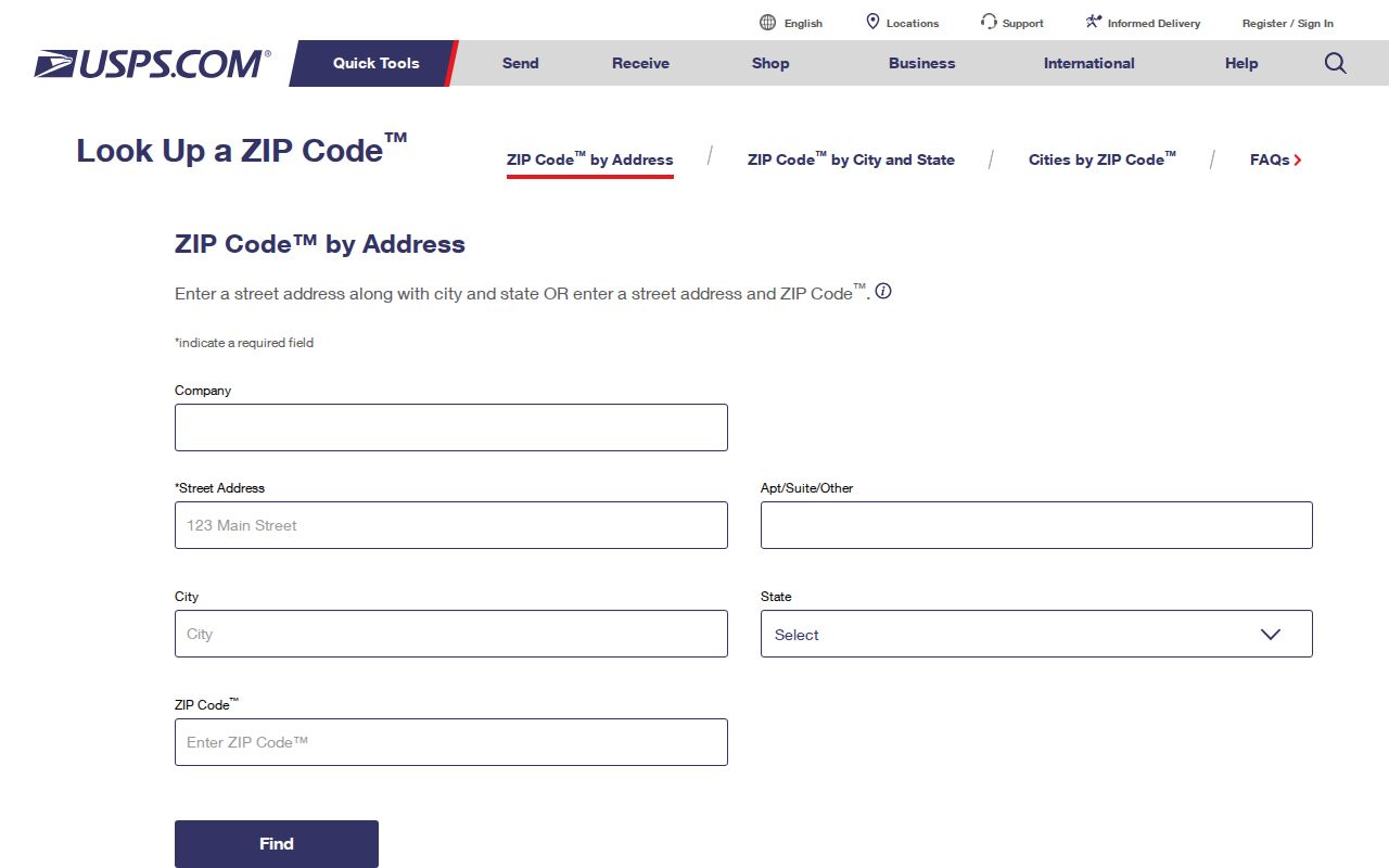
The USPS address-to-ZIP lookup is the proper check when an address search has a postal question.
The USPS ZIP Code lookup by address helps distinguish a current delivery assignment from Fullerton’s city-limit and parcel layers.
Note: A Fullerton postal address can sit outside the city polygon, while a special mailing ZIP can obscure ordinary neighborhood geography.
Fullerton Criss-Cross Directory Street Search
Historic criss-cross directories are the street directory’s occupant layer. Ask the Fullerton Public Library Local History Room for the address or householder section, not only the alphabetical surname volume. A typical entry may show a surname, given name or initial, spouse notation, occupation, “h” or “r” address mark, and sometimes a telephone. The address section arranges street, number, and listed occupant, which makes it useful for a block or a single house.
The library confirms a Fullerton directory collection, but its public page does not publish a complete shelf list or every publisher. NARA verifies Orange County volumes that include Fullerton for 1926, 1929, and 1931. A North Orange County guide describes a 1903-1928 run with missing years from 1904-1909. Ask an Archivist to confirm the actual run and whether a volume covers neighboring cities in one combined series.
Compare a first and last appearance with the nearest available year. A missing name can reflect an omitted household, spelling variation, move, annexation, or publication gap. The Fullerton city directory page follows the historical collections in greater depth, while the address trail keeps the focus on address-by-address use.
Fullerton Voter Street Data Rules
California voter registration information cannot serve as a casual Fullerton street roster. The Secretary of State and Orange County tools are built for a voter’s own status and election information. A public result can show status, party preference, districts, polling or vote-center information, and update links after identity facts are supplied. It does not authorize a visitor to search every name at an address.
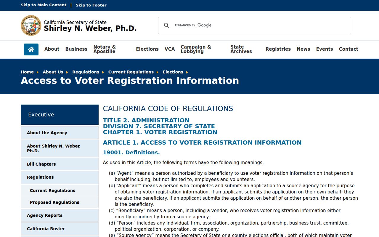
The California voter-information access rules describe fields and approved purposes under Elections Code sections 2188, 2194, and 18109 and 2 CCR sections 19001-19013.
The California election access rules explain why voter fields in a Fullerton street directory require an approved purpose and security controls.
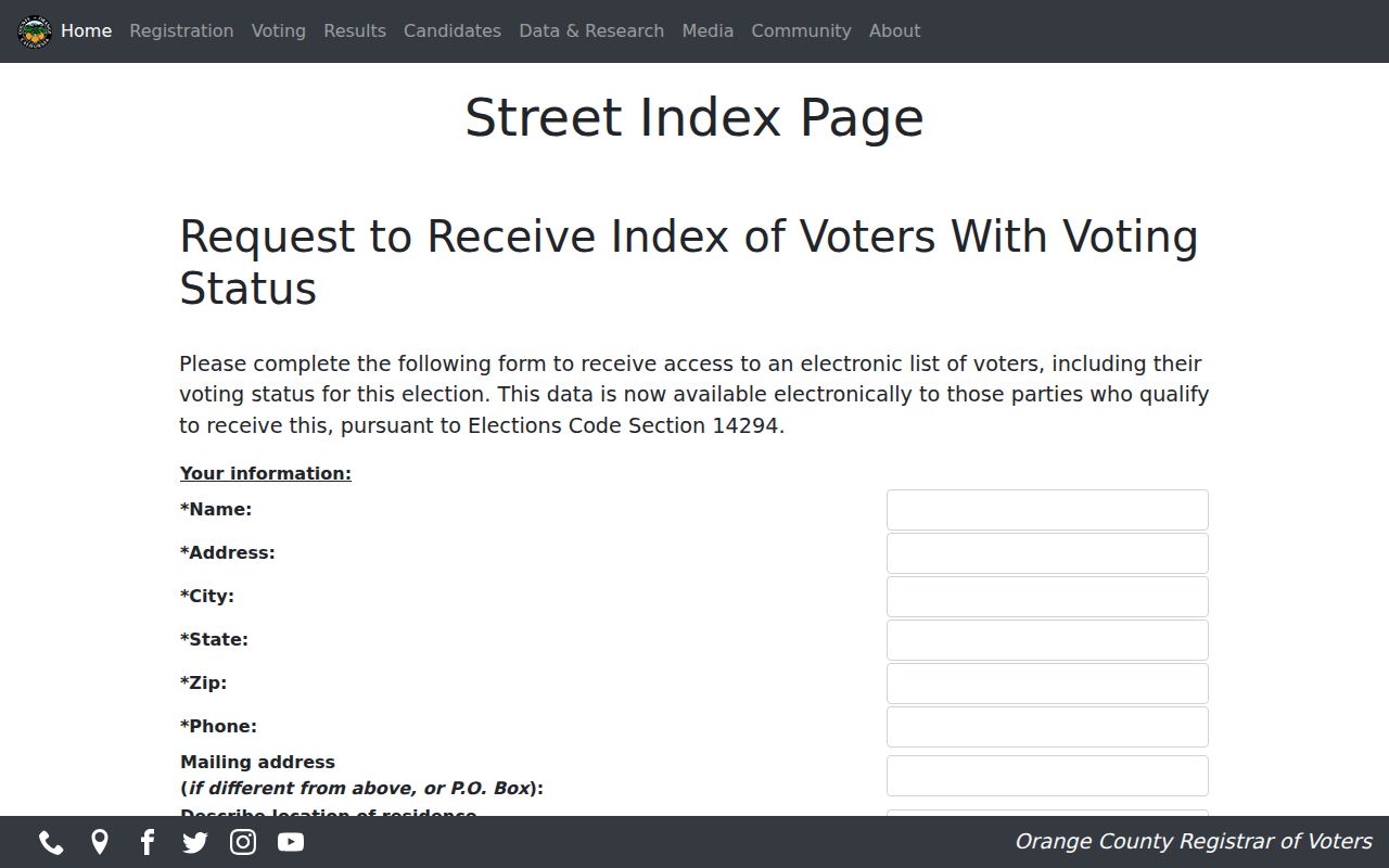
Orange County’s separate Street Index request is limited to qualifying parties under Elections Code section 14294 and asks for an electronic list with voting status for that election. The county’s data application requires a detailed intended use, wet signature, supporting identification or documents, security and storage commitments, and in-person delivery to 1300 S. Grand Avenue, Building C, Santa Ana. Email and fax are not accepted.
The Orange County Street Index request information makes the qualifying-party limit visible.
The Orange County election Street Index page is the official reference for the limited Fullerton street-directory request path.
Fullerton Address Points and Query Limits
Fullerton’s city site notes a downloadable address-point dataset updated through August 29, 2019, while the public MapServer advertises a 1,000-record maximum. That combination favors small, reproducible queries: one address, a short block, a parcel group, or a ZIP slice. A large result can be cut off, and newer construction may not appear in an older download, so the returned count is never proof of completeness.
When a street has more than one address point at a parcel, check the map and parcel layers together. Multifamily buildings, private streets, corner lots, and civic or institutional sites can create several points with one legal parcel or one mailing identity. Save the query context, then verify each APN through the county channel before moving to a deed or permit.
GIS geometry is the right tool for defining a street, block, or city boundary. It is not a substitute for a person index. Smaller geographic questions also make it easier to spot an address-number change or a ZIP that does not follow the Fullerton city line.
What a Fullerton Street Directory Misses
No public Fullerton street directory shows every person connected to a street. Non-owner occupants, family members, visitors, unlisted households, and people protected by confidentiality programs may not appear in deeds, assessment displays, directories, or voter tools. DMV personal data is restricted by the federal Driver’s Privacy Protection Act, and utility customer identity and account history are not an open resident list. A permit applicant or court party may be connected to an address without living there.
Use two or more independent clues for a name match, and state the limit of each clue. An APN and deed can support an ownership trail. A directory can place a listed adult in a year. A court index can establish a public party and case event. None of these alone proves a complete household or a current address. When the goal shifts from one street to one person, the Fullerton resident lookup path keeps the identity checks separate.
Lawful personal use. Address and street records in Fullerton support genealogy, property history, civic research, and personal safety. They do not authorize stalking, threats, doxxing, intimidation, or harassment. California Penal Code section 646.9 and related laws can apply when record use becomes a course of conduct against someone.
For a protected person, stop the search rather than attempting a cross-record reconstruction. A responsible street directory leaves a confidential address alone and verifies ordinary records with the office that holds them.